
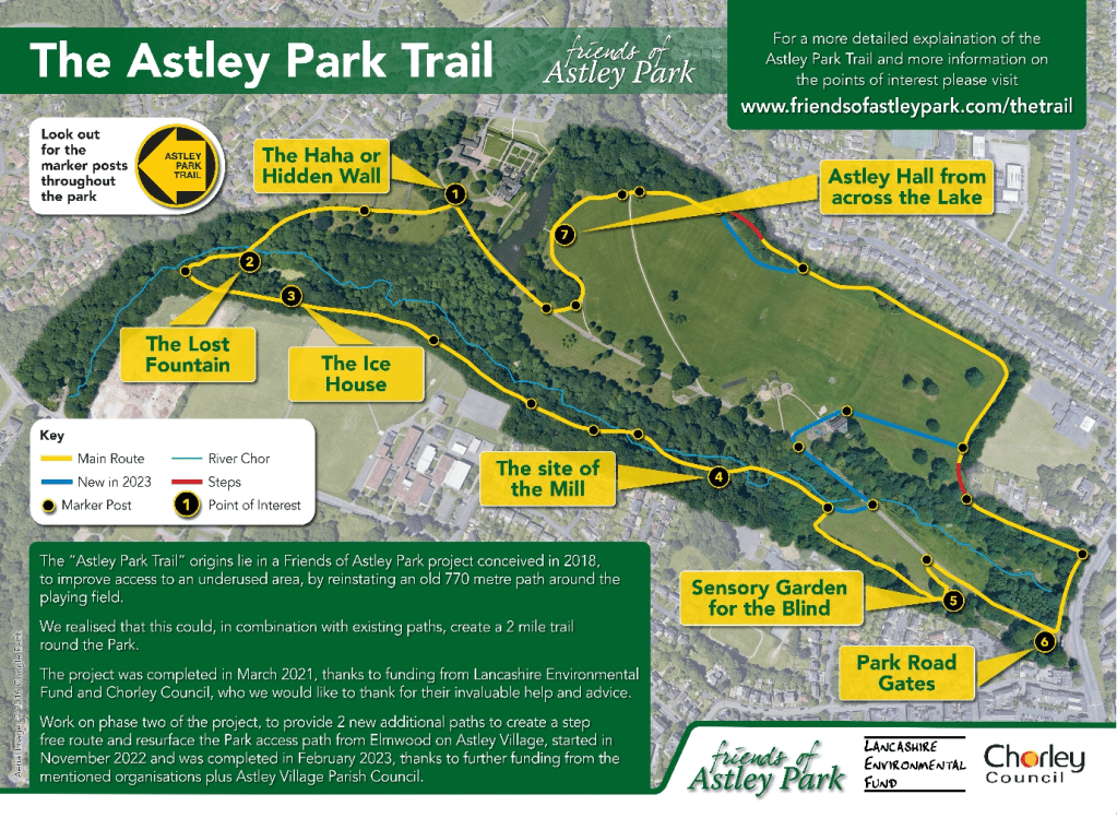
The ‘Astley Park Trail’ origins lie in a Friends’ project conceived in early 2018, to provide all weather access to an underused part of the Park, by reinstating an old 770 metre path along the north and east sides of the large playing field.
It was quickly realised that this could, in combination with existing paths, suitable information boards and way marking, create a 2 mile (3.3 km) trail round the park which would not only be great for walkers and joggers but also visitors interested in the various features along the route.
The initial project was completed in March 2021 with funding from the Lancashire Environmental Fund and Chorley Council, who we would also like to thank for their invaluable help and advice. To further improve the Trail by providing step-free access additional paths/routes (shown in blue on the map below) were built and fully opened for use by February 2023 – again supported by funding from same two organisations along with Astley Village Parish Council.
For the full story of how the whole Trail was created Click here
- Haha or Hidden Wall.
The haha can be found on either side of the gate posts that the Trail passes through quite near to the front of the hall and consists of a ditch with a wall on one side.
It is thought they originated in France and were introduced into this country during the 18th century to prevent farm animals entering the area around great houses, without any fence or wall being visible.
One explanation for the name is that it comes from the French ‘ah ah’, an exclamation of surprise.
2. The Lost Fountain
The fountain was reconstructed in 2017 as a Friends of Astley Park project. It is thought to date from c18 century or possibly earlier (Historic England document).

More information about the Lost Fountain can be found here – CLICK HERE
3. Ice House
A small rectangular ice house was located here. They were usually built partly below ground, the part above being insulated by a covering of earth. Hence this mound of earth.
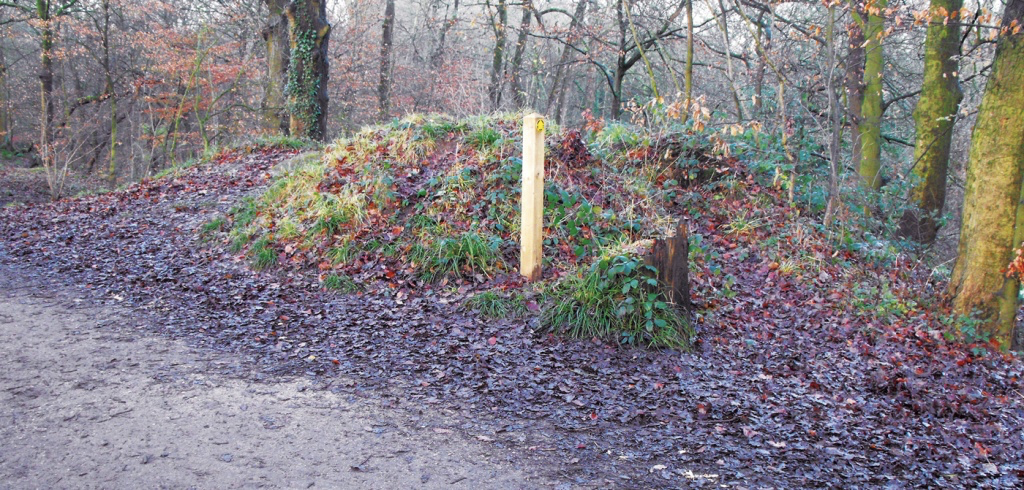
The ice house position is described in a Historic England report on Astley Hall and shown on the 1890 OS map, which also shows a track leading up to it from the pond below, probably the source of ice stored here.
4. The Site of The Mill
The 1844, OS map shows a building here which was almost certainly in use as a Carding Mill in 1780.
There was a bridge across the stream and a lane from the mill went South over it to join what is now Southport Road, then known as Ackhurst Lane.
f you look South the route of the lane is still just visible. It dates from medieval times and was known as Lidgate Lane or later Lidyate Lane. (Heyes – History of Chorley).
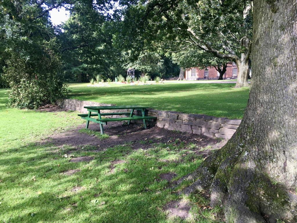
5. Sensory Garden for the Blind
The Sensory Garden, was originally the “Blind” garden built in 1953, replanted in the 1990s and completely restored in 2014.

For more information about the Sensory Garden for the Blind – CLICK HERE
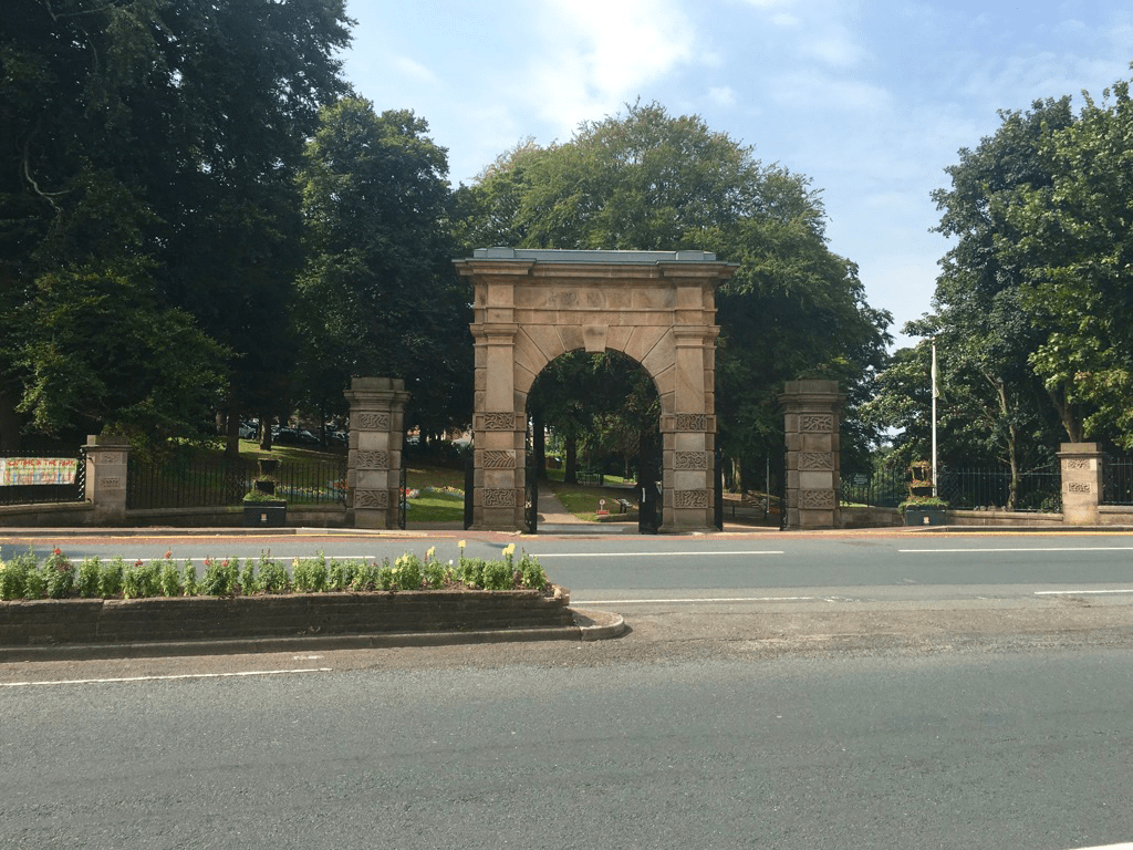
6. Park Road Gates
The imposing Memorial Entrance Gateway dates from early 19th century and was purchased by the corporation from the Gillibrand estate. It was brought here and erected as part of the War Memorial in 1922.
The Reed Bed
About 40metres north west of here there is another ‘Friends’ project, a reed bed designed to help improve water quality in the Chor. More details are on the information board on the Trail just north of here.

For more information about the Reed Bed – CLICK HERE
7. Astley Hall from across the Lake
Astley Hall is Grade 1 listed. Built c1575 by the Charnock family as a timber framed house with courtyard.
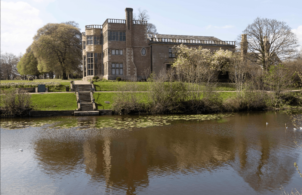
Remnants of the original building now form the north and some of the west side of the hall. The three storey frontage was added c1650, the east wing was added in 1825 and c1875 some small additions were made to the north east corner. It has a noted interior with a fine staircase and remarkable plasterwork.
A former stable block (now known as the Coach House), west of the Hall is grade II listed and built c1725. Astley Farmhouse, north of the stable block is, a remnant of the old home farm.
